
Spacial Design / Interaction Design / Wayfinding / User Experience Design / Design Research / Videography and Photography
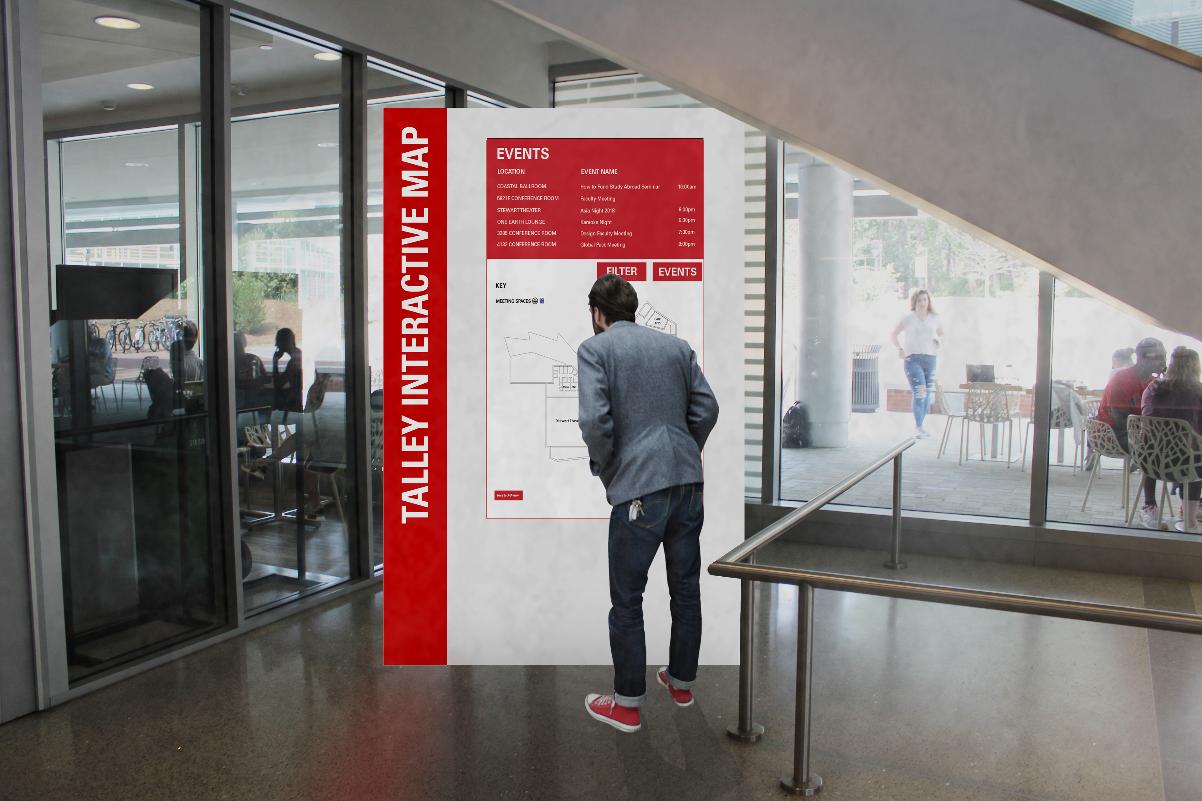
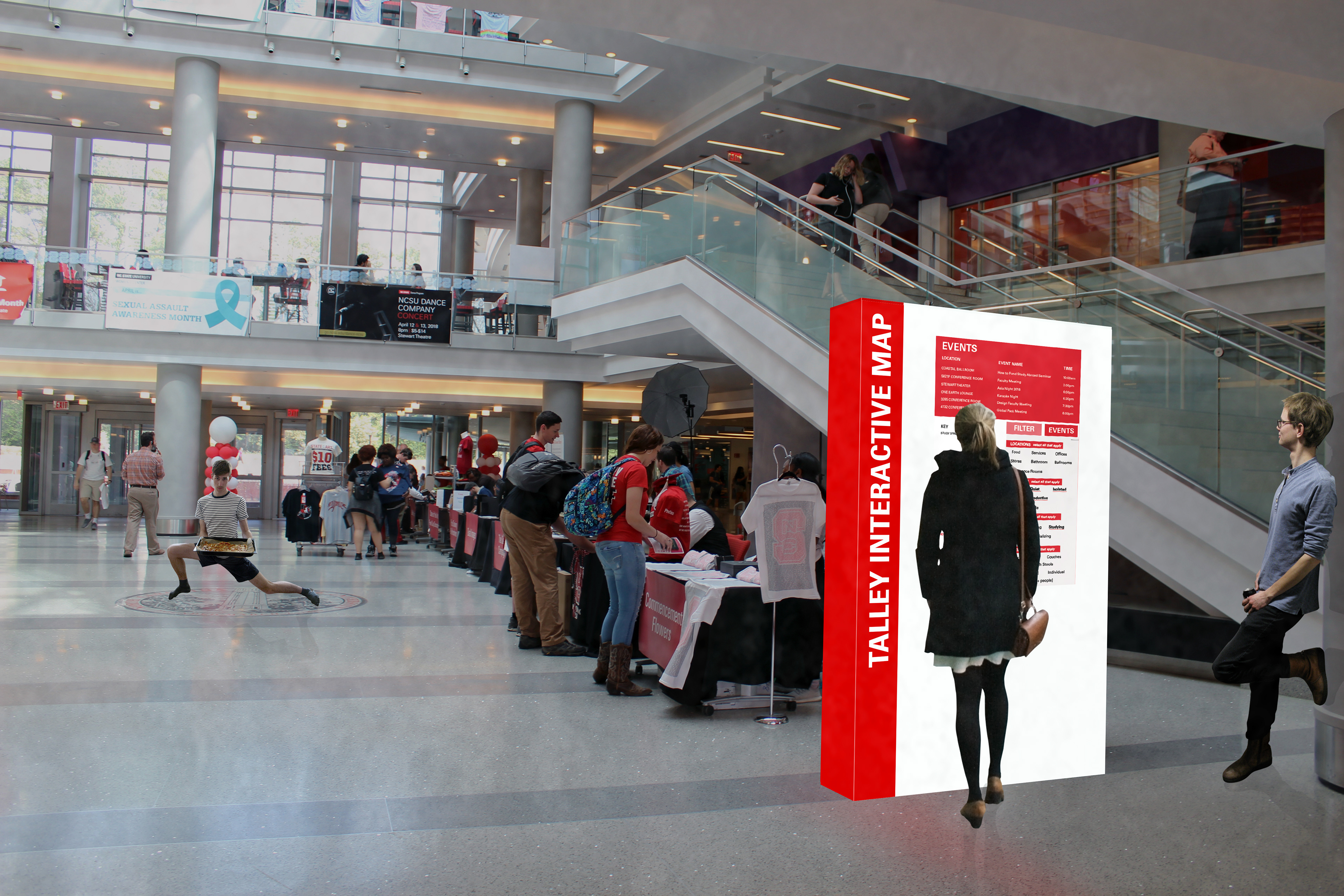
Talley Interactive Map Renderings (Interactive Map created by Sam Chang, Photoshop of users done by Liliana Carpano)

Link to Full Proposal: https://files.acrobat.com/a/preview/543f7949-46d2-4af6-9bff-a76dfe892d39
The Talley Interactive Map (or TIM) is an interactive interface designed to help students, faculty, and visitors navigate Talley easily, efficiently, and quickly using a space-finding and wayfinding system. Some problems we observed were that many people pass by the currently existing directories because they aren't that noticeable. Many people, both familiar and unfamiliar with Talley, end up wasting time wandering the building finding an ideal place to sit, study, eat, or socialize. There are also people who don't use the current spaces the way they were designed, such as one person taking up a six-person table for themselves. To combat the issue of the directories being unnoticeable, we placed them at each main entrance of Talley on the 2nd floor (main floor). The current directories are located on every floor near a staircase, rather than the entrances of Talley.
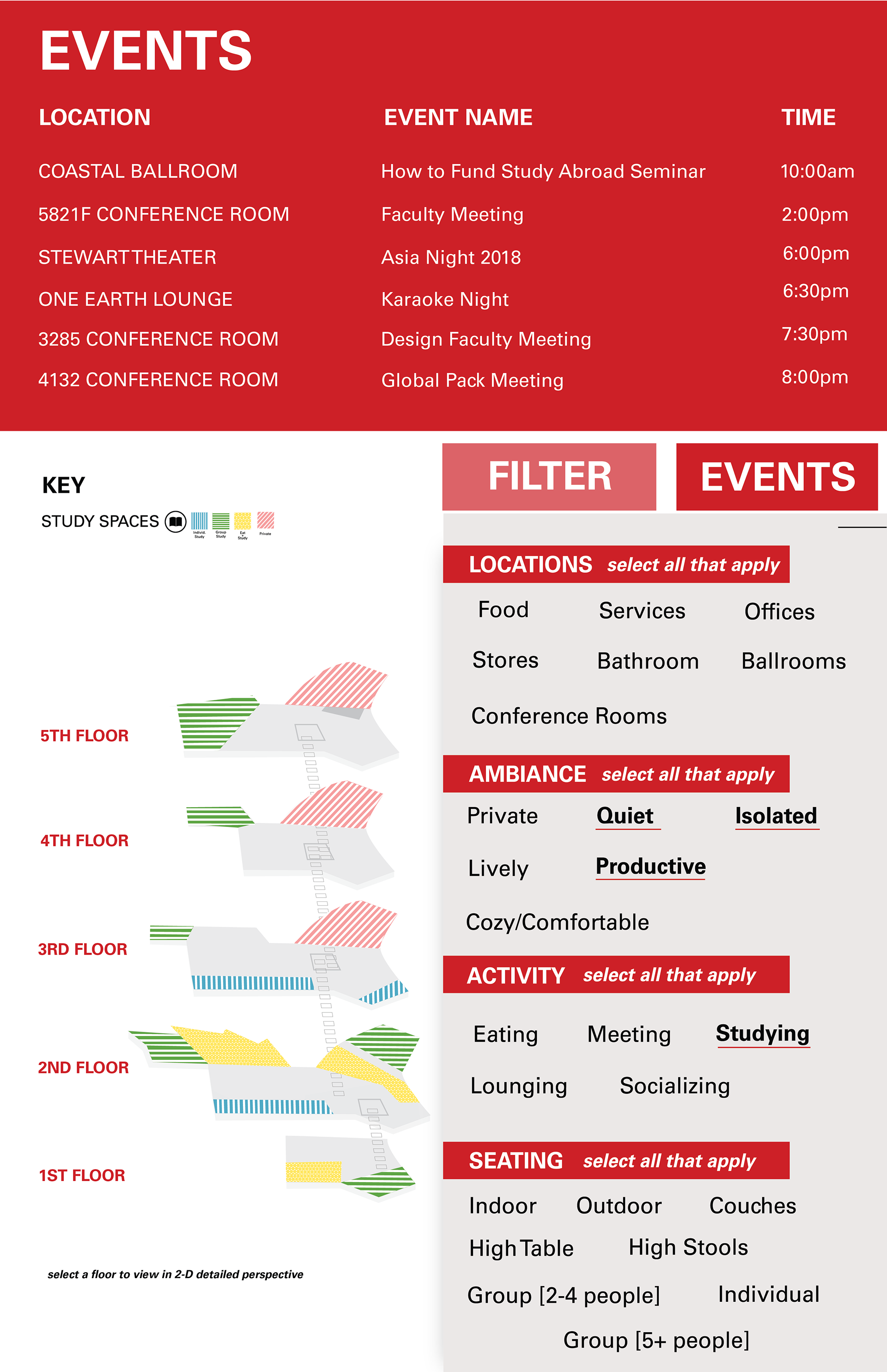
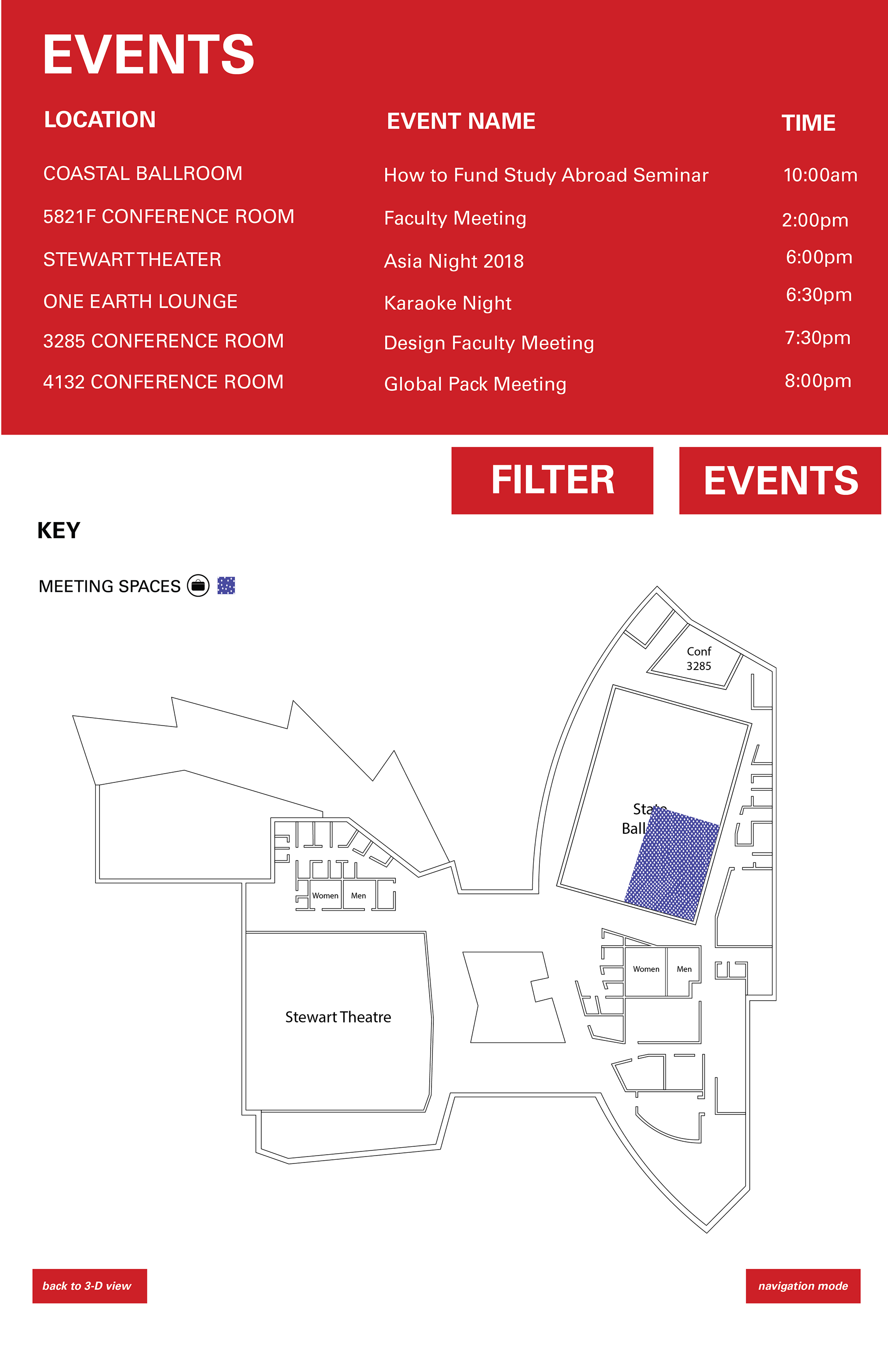
TIM is lit up on the red bar on the side, allowing people to notice it easily. The design includes an events tab located on the top for a quick preview for the passerby, as well as a more in-depth events tab that lists events for the current day, the week, and the month. Visitors can use the events tab to explore things to do in Talley, whereas faculty can use it to find a meeting in a conference room.
Our design also features a filters tab where users that are looking for specific spaces (for example, "quiet" and "study") can find areas in Talley that embody those characteristics. If you click on a specific location such as a conference room, the map will show you different routes to get to the location. It will also allow you to scan a QR-code so that the directions will be transferred to the user's phone for reference. A student would be able to use the filters to locate a space that suits their needs or a study group could find an area that accommodates more than two or three people. These filters will better guide people to spaces that suit their needs and will help users use the spaces and Talley's resources to the fullest potential.
The map is also accessible to all. It is color-coded and texture-coded, which allows the colorblind to be able to decipher between regions of the map instead of relying on the color code. Talley is a very central location on campus, similar to a metropolitan mall combined with event spaces, study spaces, eating spaces, and meeting spaces. The need for it to be accessible to as many kinds of people as possible is integral to our design.


The screens of the interface designed by Sam Chang
Interviews with a student, Talley employee, and a NC State Faculty Member about Talley Student Union.
Shot and edited by Sam Chang and Sarafina Kamara.